Platte River Below Chatfield Reservoir
Platte River Pictures and Information
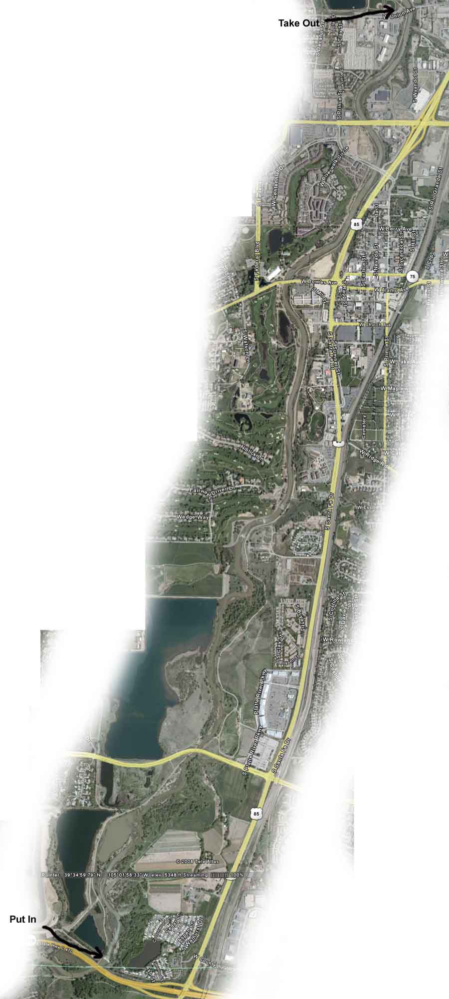
Location
This stretch of the Platte River is located 13 miles SW of Denver.
Map showing put in spot for this part of the Platte River
Description
Although this part of the Platte River runs through the city of Lakewood and Denver, there is no development at the rivers edge. You don't see much evidence of the city from the river and there isn't even much traffic noise. Most of this stretch of the Platte is bordered by parks and bike paths so the city does not encroach on the river much. You will occassionaly see other people canoeing and kayaking on this part of the Platte. Access to both the put in and take out is very easy. There are about 6 very short class 2 rapids. Portage around these is moderately easy.
Warnings, Tips, & Other Details
This stretch of the Platte is 5.4 miles and will take about 4 hours to paddle at a relaxed pace. If you don't have a second vehicle, or want to take a taxi or buss, there is a very nice bike path that runs along the river. The bike ride from the Union Avenue take out spot to the C-470 put in is an easy ride that will take 40 minutes at a good pace. The bicycle path does not take you into any traffic at any point. All of the bridges have street names on them that can easily be seen from the river as you approach them. The Union Street bridge (the take out spot) is also clearly marked so it's not easy to miss. Take out is on the left side of the river. The CFS must be above 200 to do this run. If the CFS is over 550 it can be tricky to stop before the rapids and portage around them. There are about 6 class 2 rapids and if you don't have any whitewater experience you will get wet and/or swamp your canoe. Portage around these rapids is moderately easy. When I do this run I like to stop on the right side of the river at the Prince Street bridge to get a bite to eat. There are about 5 restaurants just a couple hundred feet from the river here. The Prince Street bridge is about 3/4 of the way through the trip.
Real time river gauge for this part of the Platte River
Where to Park
Put In - The exit can only be accessed from C-470 going west. Go west on C-470 one exit past Santa Fe Drive. When you get off the exit follow the road around to the right and merge on to Chatfield Avenue / Platte Canyon Road (Chatfield Ave turns into Platte Canyon Road). Go .42 miles and turn right onto Depew Street. Follow this road for 1.3 miles until it dead ends at the parking lot.
Take Out - On Union Avenue 1/2 mile west of the intersection of Santa Fe Drive and Union Avenue. There is a baseball field here on the North side of Union Avenue. Park at the far right side of the parking lot here at the baseball field.
Pictures
Platte River in Lakewood, CO